

The drilling program is running. The data exists. Yet every target meeting still begins with someone exporting a spreadsheet from one system and trying to reconcile it with a model from another.
This is the real problem with most exploration stacks: Not that teams lack software, but that none of it talks to each other in a way that produces reliable decisions. Drillhole logs live in one place, assay results in another, geological interpretations in a third. By the time a target recommendation reaches a decision-maker, two of those inputs are already out of date.
The question worth asking is not "do we have enough tools?" It is whether the stack turns geological evidence into decisions you can actually defend to a board or investor. Only 43% of surveyed organizations had AI-powered analytics in production as of 2025, according to a Strategy global survey, and the gap between data collected and decisions made remains the core friction in mineral exploration programs.
This guide cuts through the category confusion. It covers seven specialist platforms and helps you match each to the decision it actually improves.
What's inside
This guide is for founders at mining technology companies and resource-focused businesses evaluating how exploration software choices affect capital allocation, data reliability, and investor confidence. Items were selected based on these criteria:
- Category coverage: Tools must serve a distinct workflow, from exploration intelligence to geological databases and operations management
- Verified pricing and ratings: Every price and G2 rating was checked against live vendor pages in October 2026
- Founder relevance: Each tool is framed around the operating consequences it changes, not just feature checklists
- Market presence: Included platforms have documented adoption by mining and geoscience teams
TL;DR
- Best for exploration intelligence: VRIFY, for teams that need AI-assisted target generation and investor-ready project visualization
- Best for 3D geological modelling: Leapfrog Geo, for geologists converting drillhole evidence into dynamic subsurface interpretations
- Best for drilling operations: CorePlan, for exploration managers who need weekly visibility into program execution and cost without manual reconciliation
- Best for technical resource workflows: Maptek Vulcan, for teams whose geological modelling feeds directly into resource estimation and mine planning
- Best for connected exploration data: MX Deposit and Imago for validated drillhole records and geological imagery, Target for integrated field mapping and visualization
What is exploration software?
Exploration software is a category of tools that helps mineral and geology teams collect, manage, validate, interpret, model, and communicate exploration data before development decisions are made.
The category is not a single interchangeable class. It includes five distinct product types, each addressing a different part of the workflow from field through investment decision.
| Category | What it handles | Typical decision supported |
|---|---|---|
| Exploration intelligence | Geospatial data aggregation, AI-assisted target ranking | Where should we focus the next field program? |
| Geological databases | Drillhole, assay, sample, and survey records | Can we trust the source data feeding interpretation? |
| 3D geological modelling | Surfaces, wireframes, domains, subsurface interpretation | What does the geology suggest in three dimensions? |
| Operations software | Drilling activity, contractors, budgets, site reporting | Are the program and budget on track? |
| Imagery platforms | Core photos, metadata, QA/QC, visual evidence management | What physical evidence supports this interpretation? |
Key capabilities to look for
- Centralized geological and operational data with role-based access
- Drillhole, assay, and sample validation with audit trails
- GIS and geospatial data integration
- 3D geological visualization and modelling
- Target generation and prospectivity analysis
- Integration with laboratory systems, field apps, and modelling platforms
Where general BI tools fall short
General data visualization tools can summarize numbers across a dashboard. Specialist exploration platforms handle geological context: Spatial relationships, drillhole structure, QA/QC rules, and technical interpretation. The distinction matters when an investor or auditor asks you to trace a resource estimate back to its source data.
When to use exploration software
Centralize fragmented exploration data
If your team has drill logs, assay results, core imagery, and contractor reports scattered across shared drives and spreadsheets, the first purchase is almost always a data management foundation. Interpretation built on an untrusted dataset creates rework. The correct sequence is clean data first, then model.
Build and test geological interpretations in 3D
Flat maps and spreadsheets cannot show spatial relationships between drillholes, geological domains, and target zones. When the decision depends on understanding subsurface geometry, a 3D modelling platform moves from optional to essential. Competing target hypotheses require competing models.
Prioritize targets and communicate the case to stakeholders
Leadership teams allocating drilling capital and founders reporting progress to investors need more than a map with dots. Exploration intelligence tools make uncertainty visible rather than hiding it behind a static PDF. The clearer the target rationale, the more defensible the capital decision.
Exploration software comparison
These seven platforms do not compete on identical jobs. The table below is designed to prevent category confusion, not to pick a single winner across all workflows.
| # | Product | Best for | Key differentiator | Pricing | G2 rating |
|---|---|---|---|---|---|
| 1 | VRIFY | AI-assisted target generation and investor communication | Exploration intelligence combining geospatial data, prospectivity mapping, and interactive 3D presentations | Contact for quote | N/A |
| 2 | Leapfrog Geo | Dynamic 3D geological modelling | Rapid subsurface model updates as new drillhole data arrives | From $164.25/day (consultant) | 4.5/5 |
| 3 | CorePlan | Drilling operations and program execution | Unified drilling, field, cost, and contractor workflows for exploration teams | From $750/month | 4.7/5 |
| 4 | Maptek Vulcan | Technical geological modelling and resource workflows | Integrated geological modelling, grade estimation, and mine design in one platform | Contact for quote | 4.4/5 |
| 5 | MX Deposit | Drillhole and sample data management | Centralized drillhole data validation with real-time collaboration and audit trails | From $1,265/year (Reviewer) | N/A |
| 6 | Imago | Core imagery and geoscientific visual records | Cloud-based imagery catalogue with AI image analysis and cross-platform integration | Contact for quote | N/A |
| 7 | Target | Geological field mapping and drillhole visualization | Multi-format data import, 3D visualization, and geochemical analysis for early-stage exploration | Contact for quote | N/A |
Best 7 exploration software tools for 2026
1. VRIFY
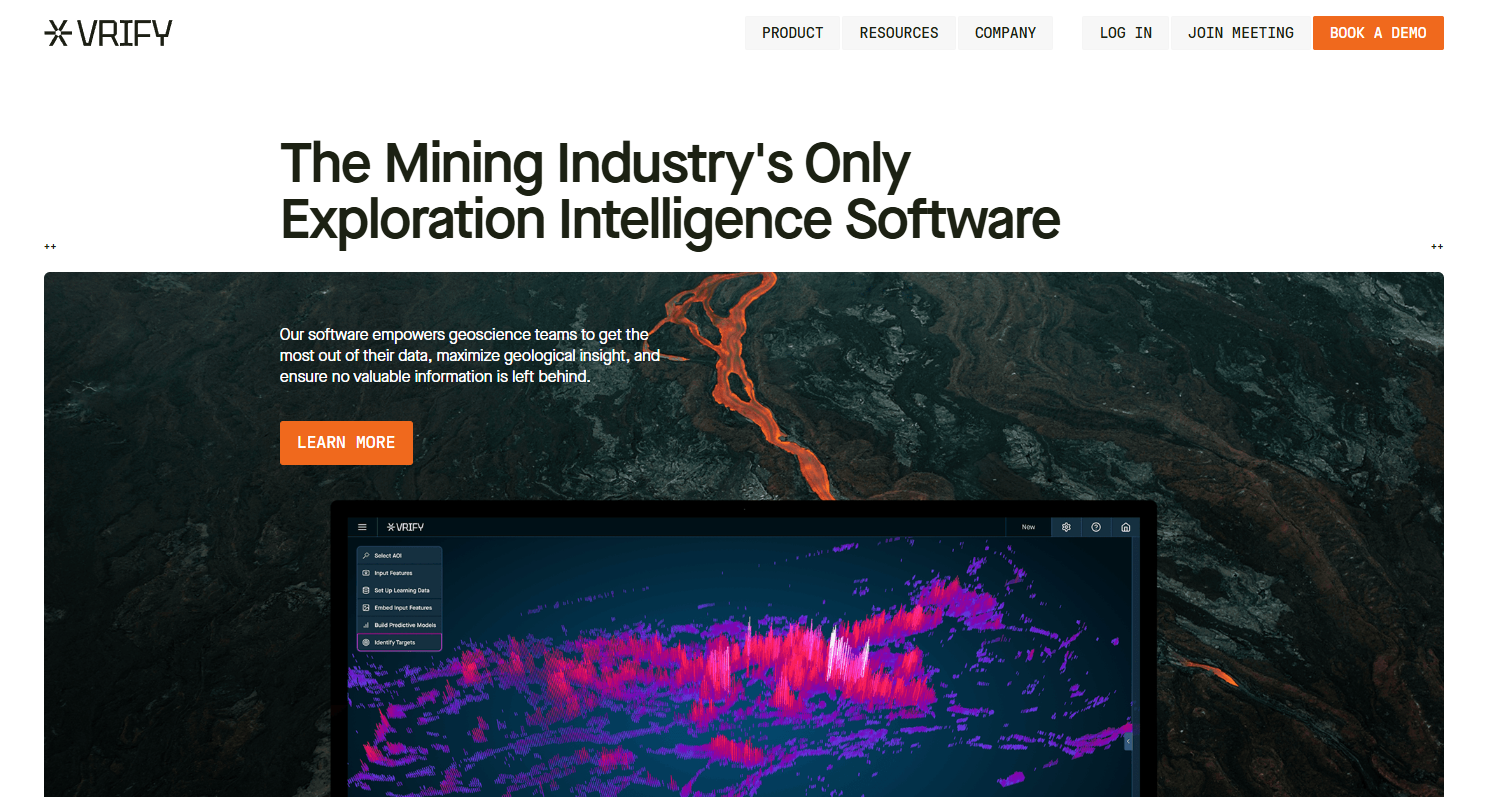
VRIFY is an exploration intelligence software platform built for mineral exploration and mining teams. It combines AI-powered prospectivity mapping with geospatial data assembly and interactive 3D presentations, serving both the technical team generating targets and the leadership team communicating the investment case. VRIFY's DORA and VRIFY Predict modules handle data ingestion, standardization, and iterative model refinement.
Best for: Mining and mineral exploration companies that need AI-assisted target generation alongside investor-ready visual communication.
Key features
- AI-powered prospectivity mapping via VRIFY Predict and DORA
- Geospatial data ingestion, standardization, and augmentation
- Iterative target model refinement
- Interactive 3D presentations combining 360° imagery and corporate slides
- Stakeholder communication tools for investors, permitting, and community
Why choose VRIFY: This is the right evaluation when the team's core problem is choosing where to allocate exploration effort and then explaining that rationale clearly to nontechnical stakeholders. It covers the decision-making layer that most geological databases and modelling tools leave to slide decks and spreadsheet exports.
VRIFY pricing: VRIFY directs prospects to book a demo; client terms reference subscription and project fees specified in an authorization form. Contact VRIFY directly for current package and subscription details.
2. Leapfrog Geo
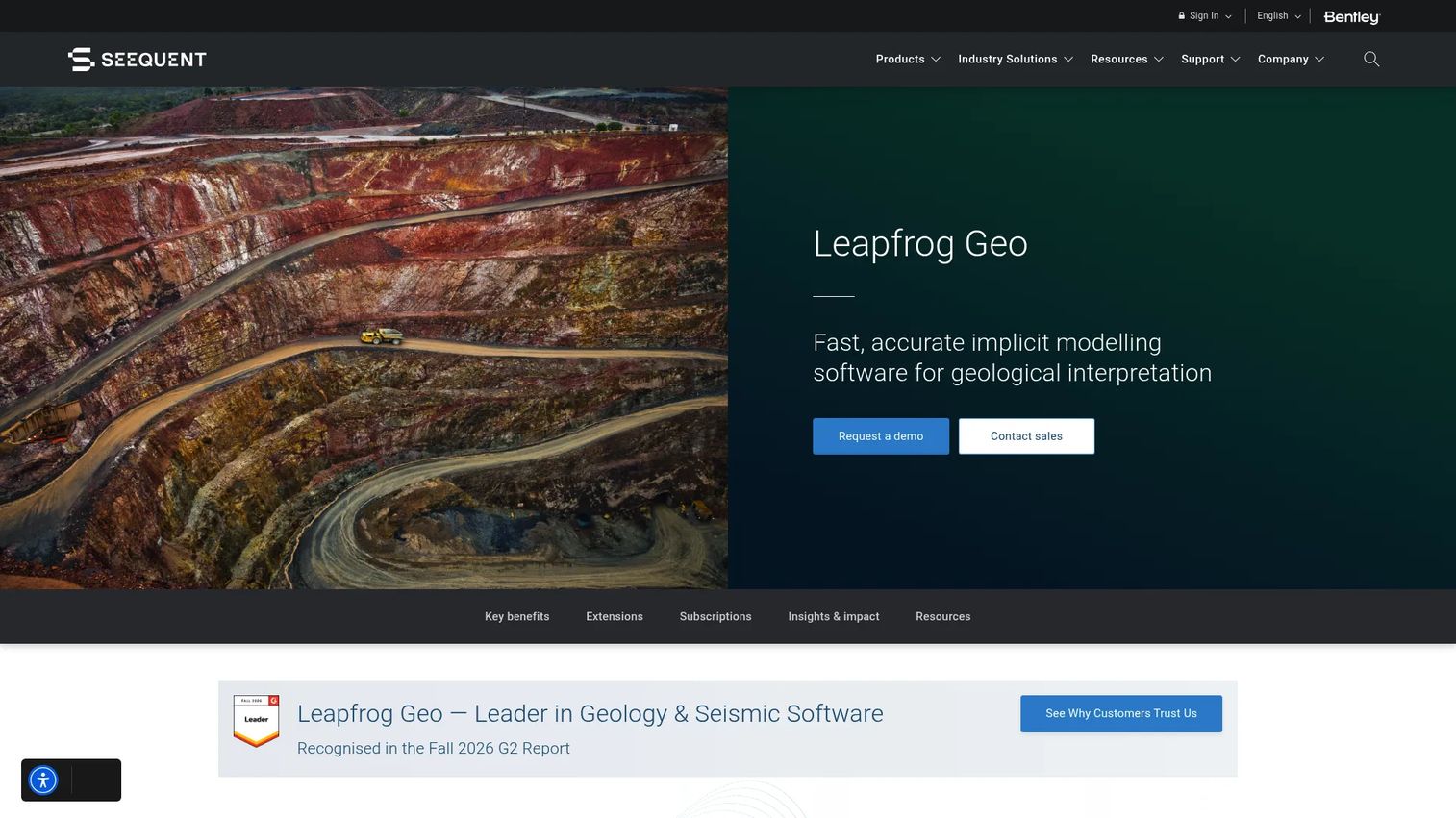
Leapfrog Geo, developed by Seequent, is a 3D geological modelling platform used across mining and geoscience programs. Its core design centers on rapid model updates as new drillhole and field data arrives, rather than requiring teams to rebuild interpretations from scratch each time. It supports advanced geological modelling, numeric and block modelling, and 2D and 3D visualization in a single environment.
Best for: Exploration geologists converting drillhole and field evidence into working dynamic subsurface interpretations.
Key features
- Dynamic 3D geological model construction and updates
- Drillhole data integration with visualization
- Geological surface and domain modelling
- Numeric and block modelling
- 2D and 3D cross-section visualization
Why choose Leapfrog Geo: Choose this when the technical decision depends on spatial relationships that flat maps cannot show. It fits teams iterating on competing geological interpretations as drilling results arrive, supporting drill targeting, domain interpretation, and resource-stage communication.
Leapfrog Geo pricing: A consultant daily rate of $164.25 USD per day is listed on Seequent's site, capped at 15 days or $2,463.75 USD per calendar month. Named and shared 12-month license prices are not displayed publicly; contact Seequent for annual license terms.
G2 rating: 4.5/5 on G2.
3. CorePlan
CorePlan is a drilling management and exploration operations platform built for mining companies, exploration teams, and drilling contractors. It replaces the cycle of exporting field reports and reconciling contractor invoices manually by putting drilling activity tracking, digital shift reports, cost summaries, and contractor portals in one operational system. CorePlan integrates with Power BI, SAP, Seequent, QGIS, Micromine, and several ERP and geological tools.
Best for: Exploration managers who need accurate weekly visibility into drilling progress, contractor performance, and budget status without manual data reconciliation.
Key features
- Digital shift report (Plod) capture, review, and approvals
- Drilling cost tracking and budget summaries
- Rig scheduling and production performance analytics
- Contractor and client portals with offline mobile access
- Custom dashboards and integration with Power BI and ERP systems
Why choose CorePlan: If the program is growing, contractors are involved, and the founder or operations lead still reconciles field updates in spreadsheets before approving spend, CorePlan removes that step. The value is operational discipline and faster cost visibility, not geological interpretation.
CorePlan pricing: Drilling Hub starts at $750/month billed annually for the Basic plan. Mining and Exploration Hub starts at $1,350/month for Starter. Higher tiers use custom pricing. Add-ons include Field Operations Management from $800/month.
G2 rating: 4.7/5 on G2.
4. Maptek Vulcan
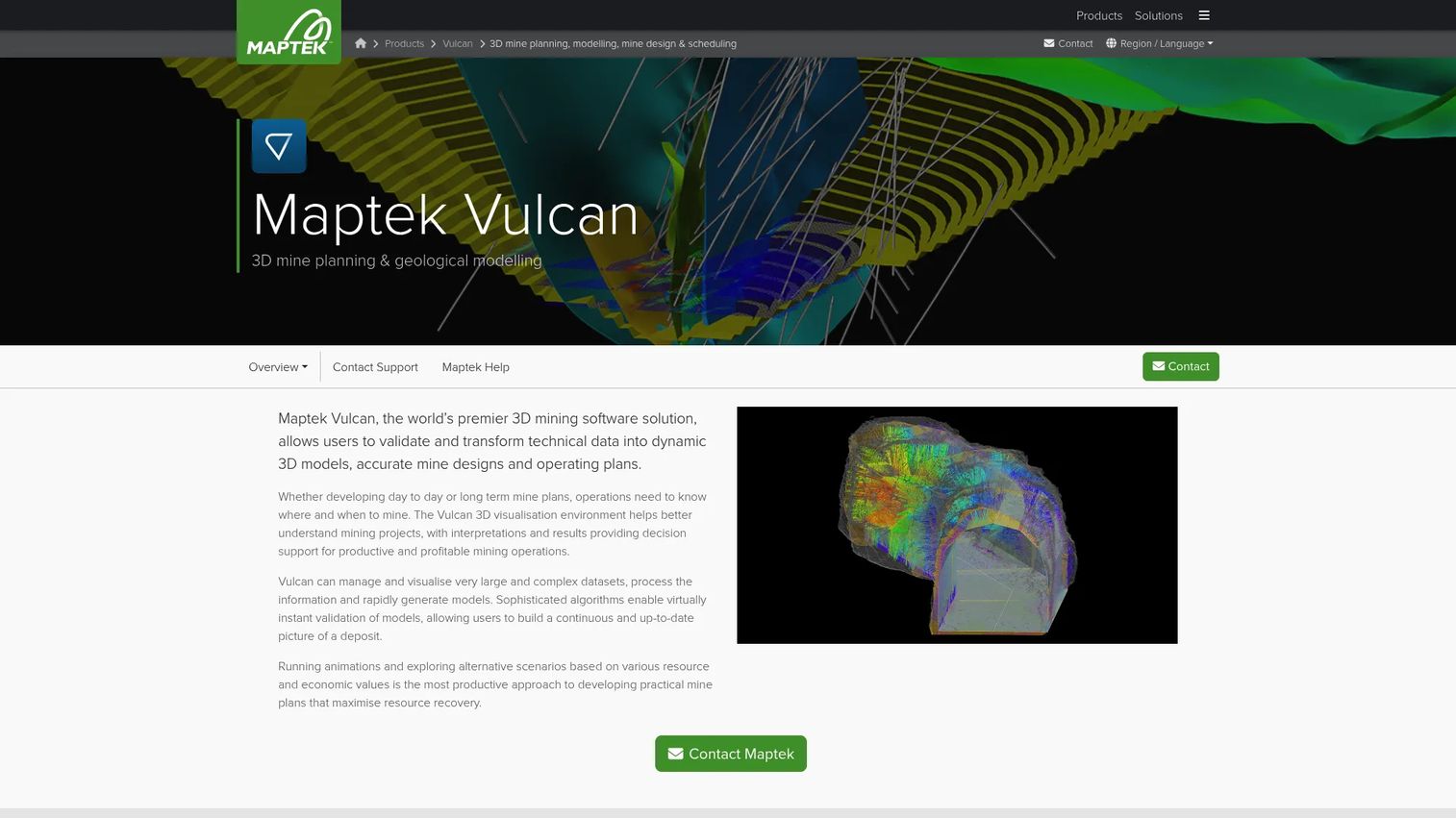
Maptek Vulcan is a 3D mining software platform covering geological modelling, mine design, scheduling, and technical data analysis. For exploration-stage teams, the relevant angle is its role in geological interpretation, block modelling, geostatistics, and grade estimation, combined with a workflow that scales into later-stage resource and planning work. New offerings are subscription-based through Maptek Account.
Best for: Technical geology and resource teams who need established modelling depth and a workflow that can carry geological data from exploration through resource declaration and into mine planning.
Key features
- 3D visualization and management of complex mining datasets
- Block modelling, geostatistics, and grade estimation
- Geological modelling and domain interpretation
- Mine design, drill-and-blast, and grade control tools
- Integration with Maptek's broader technical platform
Why choose Maptek Vulcan: This fits teams with complex technical requirements who expect exploration data to feed resource estimation and eventually planning work. The implementation investment is real, requiring capable technical users and established workflows. The payoff is not needing to migrate data to a different system later.
Maptek Vulcan pricing: Subscription-based, available through Maptek Account. Pricing varies by subscription period and configuration. Contact Maptek for a current quote.
G2 rating: 4.4/5 on G2.
5. MX Deposit
MX Deposit is a cloud-based geological database software platform from Seequent for collecting, managing, validating, and sharing drillhole and point-sample data across mining and exploration programs. It supports dynamic logging with built-in validation, real-time collaboration, and audit trails. Three named license tiers serve different user roles within a program, from full logging access to read-only review.
Best for: Mining and exploration organizations that need a controlled, auditable system of record for drillhole, assay, and sample data across distributed teams and multiple contributors.
Key features
- Drillhole and point-sample data management with dynamic logging
- Built-in validation and QA/QC workflows
- Real-time collaboration with full audit trails
- Data access controls by user role
- Integration with Leapfrog and other Seequent products
Why choose MX Deposit: The case for MX Deposit is traceability. When a geologist needs to trace a model input back to its source drillhole, or an investor asks for evidence behind a resource assertion, a governed database saves significant time. It does not replace modelling or operations software; it makes the data feeding both more trustworthy.
MX Deposit pricing: Reviewer license costs $1,265 USD per year (12-month named license). Standard User is $3,705 USD per year. Shift User is $5,055 USD per year. Shared and enterprise license terms require contacting Seequent.
6. Imago
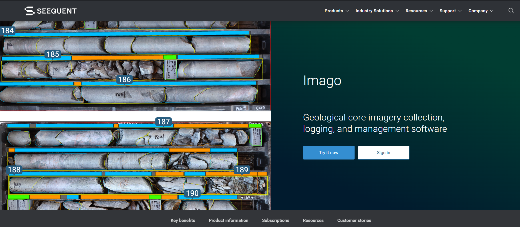
Imago, also part of Seequent's portfolio, is a cloud-based geological imagery platform for capturing, cataloguing, analyzing, and sharing core imagery and geoscientific visual records. Its Capture X camera workflow automatically labels, crops, and stores images at the point of capture. AI image analysis covers RQD, colour analysis, depth mapping, and linearisation, integrating with Leapfrog Geo, MX Deposit, and Oasis montaj.
Best for: Geology and technical services teams that need searchable, standardized geological imagery connected to the broader program database.
Key features
- Capture X automated image labelling, cropping, and storage
- AI image analysis: RQD, colour, depth mapping, and AutoCropping
- Cloud-based imagery catalogue with stakeholder sharing
- API data access and integration with Leapfrog and MX Deposit
- Standard and Enterprise plans with different storage and workspace configurations
Why choose Imago: Core imagery trapped in local folders or personal drives creates interpretation risk and slows review cycles. Imago's value is making visual geological evidence findable, reviewable, and connected to the records that feed modelling decisions. It fits programs that need to maintain visual evidence quality across distributed logging teams.
Imago pricing: Standard and Enterprise plans are 12-month subscriptions; prices are not displayed on the product page. Junior licensing is available for non-producing or academic organizations. Contact Seequent for current rates.
7. Target
Target (Geosoft Target) is a geological field mapping and drillhole visualization platform from Seequent, oriented toward early-stage mineral exploration. It handles data import from more than 50 supported formats, drillhole planning in 2D and 3D, geochemical analysis and QA/QC, and composite calculation. The platform connects subsurface data from field collection through interpretation in a single geological database environment.
Best for: Early-stage exploration organizations integrating drillhole, geophysical, geochemical, and GIS data for target identification and visualization.
Key features
- Data import from 50+ supported formats
- 2D and 3D drillhole planning and visualization
- Geochemical analysis with QA/QC and composite calculation
- 3D geological models, voxel and block models, and isosurfaces
- Integration of drilling and subsurface data with GIS layers
Why choose Target: The strongest fit is early-stage programs that need to bring together field data from multiple sources before modelling becomes the primary activity. When the team's bottleneck is understanding what the existing dataset suggests about subsurface geology, Target provides the visualization and data structure to answer that question without requiring a full modelling platform from day one.
Target pricing: Pricing is not displayed on the product page. Contact Seequent to discuss licensing options.
Considerations when choosing exploration software
Match the software category to the actual bottleneck
The most common purchasing mistake is buying a modelling platform when the real problem is unreliable source data, or an operations platform when the constraint is target interpretation. Identify the decision that stalls most often, then choose the product category that changes it. If you cannot trace a model input back to its source, start with a geological database. If contractors and field costs are the chaos, start with operations software. Consider reviewing 3D visualization software options if geospatial display rather than full modelling is the primary need.
Test data lineage before evaluating visualization quality
A well-designed dashboard is not evidence that the data behind it is trustworthy. Before committing to any platform, ask whether a geologist can trace an interpreted result back to its drillhole, assay, survey, and source metadata. A fast answer matters when investors, auditors, or technical reviewers challenge a resource assertion.
Price the implementation, not only the license
The license fee is one part of the cost. Account separately for data migration, historical record cleanup, field-process changes, user training, and ongoing system ownership. A narrower product can be cheaper to adopt. A broader platform can cost less overall if it removes several manual workflows that currently consume technical staff time.
Check integration and export requirements before committing
Inventory the systems already in use: GIS platforms, laboratory management systems, field capture apps, contractor reporting tools, and existing modelling environments. Confirm which integrations are native versus export-based, and which require professional services. Gaps in this area become maintenance costs after go-live.
Name an accountable data owner before rollout
Exploration data systems fail when nobody owns validation standards, permission structures, or release processes. Designate a technical owner responsible for data governance before migrating records. Treat the implementation as an operating change with defined accountability, not a software installation.
Conclusion
Exploration software is not one category with one winner. The best choice depends entirely on where a program loses time, trust, or capital efficiency.
For AI-assisted target generation and investor communication, VRIFY covers the decision-making layer that most other tools leave to static reports. Leapfrog Geo is the standard evaluation for teams that need dynamic 3D geological interpretation as new data arrives. CorePlan fits programs where operational visibility and cost control are the primary gaps. Maptek Vulcan serves technical teams whose geological work feeds directly into resource and planning workflows.
For programs building a reliable data foundation, MX Deposit handles drillhole and sample records with validation and audit trails. Imago centralizes core imagery and connects visual evidence to broader geological databases. Target supports early-stage programs that need to bring together field and subsurface data before full modelling begins.
Start with the workflow where poor information creates the largest capital decision. A tool earns its place by reducing rework, making technical evidence easier to trust, or helping the team prioritize the next drilling dollar more confidently.
Start your journey with Guideflow today!
FAQs
Exploration software covers the tools mineral and geology teams use to collect, manage, validate, interpret, model, and communicate exploration information before development decisions are made. The category includes several distinct product types: Geological databases for drillhole and assay records, 3D modelling platforms for subsurface interpretation, operations software for drilling execution and cost control, imagery platforms for visual geological evidence, and exploration intelligence tools for AI-assisted target generation and stakeholder communication.
The best mineral exploration software depends on the workflow creating the most friction. For target prioritization using AI and geospatial data, evaluate exploration intelligence platforms. For 3D geological modelling, the decision depends on update speed and how well the tool integrates incoming drillhole data. For drilling operations and cost control, look for platforms that handle contractor reporting and budget tracking in one place. For geological data management, the priority is validation rules and audit trail quality.
3D geological modelling software builds subsurface models by combining drillhole logs, geological observations, structural measurements, and geophysical data into an interpretable spatial model. Key evaluation criteria include how quickly models update when new data arrives, which data formats the tool imports, visualization quality for technical communication, and whether the output format works with downstream resource estimation tools.
Many programs benefit from both. The geological database holds governed source records, drillholes, assays, samples, and surveys, with validation and access controls. Modelling software reads those records and interprets them spatially. Keeping the two connected reduces version confusion and supports traceability: A geologist can follow a model interpretation back to the specific validated inputs that produced it. Programs that skip the database step often face data reconciliation problems when interpretations need to be audited or updated.
AI-assisted exploration intelligence platforms combine geospatial, geochemical, geophysical, and historical datasets to help teams rank areas for further investigation. These tools support expert judgment by surfacing patterns across large datasets that would take much longer to review manually. The output is a ranked target list, not a drilling decision. Field validation, geological interpretation, and technical review remain necessary steps before committing capital.
Compare the license or subscription fee against the total cost of adoption: Data migration, historical record cleanup, training time, field process changes, integration work, and ongoing system administration. A lower entry price can produce a higher total cost if it leaves key workflows manual or requires significant professional services to configure. The question to answer is how much technical staff time the software saves or creates, not just what the first invoice looks like.
A complete exploration data environment typically covers drillhole logs, assay results, rock and soil sample records, geophysical surveys, GIS layers, core imagery, field geological observations, QA/QC records, contractor activity reports, and model outputs. The more of these records a team can trace through a single governed system, the more defensible technical interpretations and resource assertions become.
When software makes the technical case traceable and visual, investor reporting improves in concrete ways. A program that can show current operational status, accessible geological evidence, and a clear line from source data to target rationale gives investors something to evaluate rather than a narrative to accept. Consistent source data also reduces the preparation time for due diligence, which matters when a fundraise timeline is tight.